3D model of a Site – Fly Over Mode


Description:
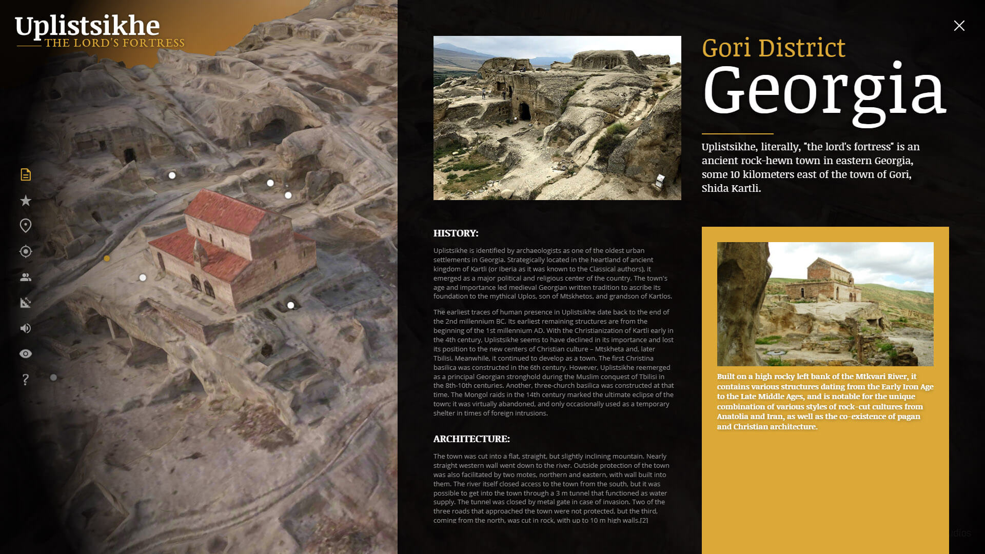
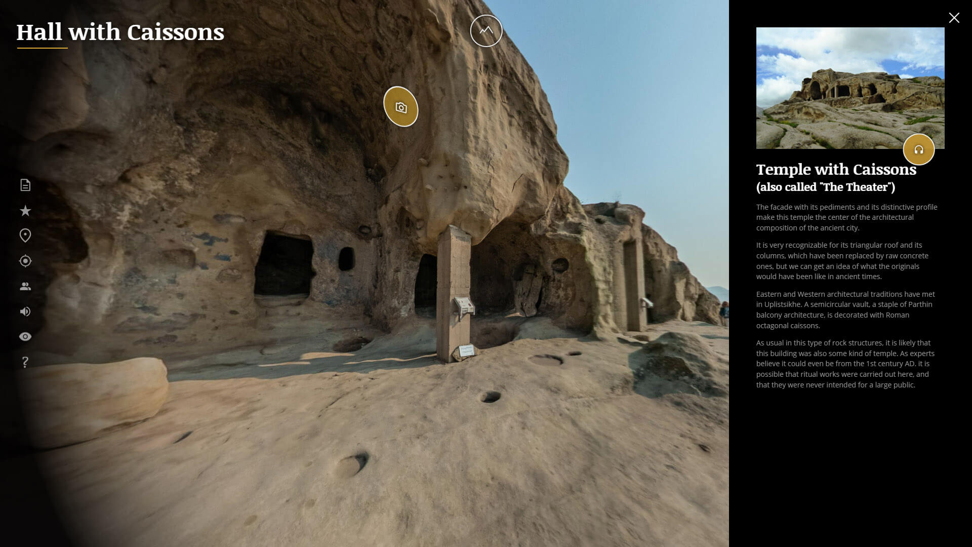
In this demo, we're connecting a 3d model of the historical complex of Uplistsikhe (Georgia) with a series of panoramic photos taken in the same place, allowing the user to navigate seamlessly between both media types. This allows you to visualize and navigate the entire area on your own terms. Change perspectives and switch easily between a "bird's eye view" and "landing" inside the most important points to see them in all the detail that the panoramic photo of each zone has to offer.
To see how this tour was created step by step, you can watch our Video Tutorial.
The 3D model used in this tour was created by means of photogrammetry. This means a drone took multiple aerial photos from different angles over the entire complex and, through a complex analysis process, software created all the geometry and applied the photos themselves for the textures. This allows us to create a detailed and accurate virtual twin of the real site. On the other hand, in situ panoramas were made in the most prominent areas of the complex using 360º cameras. All this was realized by WeScan Georgia.
Subsequently, we use VTPro to link and connect both media types and build the entire "experience" of the tour by adding skin windows, historical information, areas of interest, measurement options, detail photos, etc.
We also created an intro sequence, directly inside VTPro, similar to a presentation video, with the camera passing through different areas and catchy phrases that are superimposed as well as background music – leaving us well immersed into the past of the ancient city.
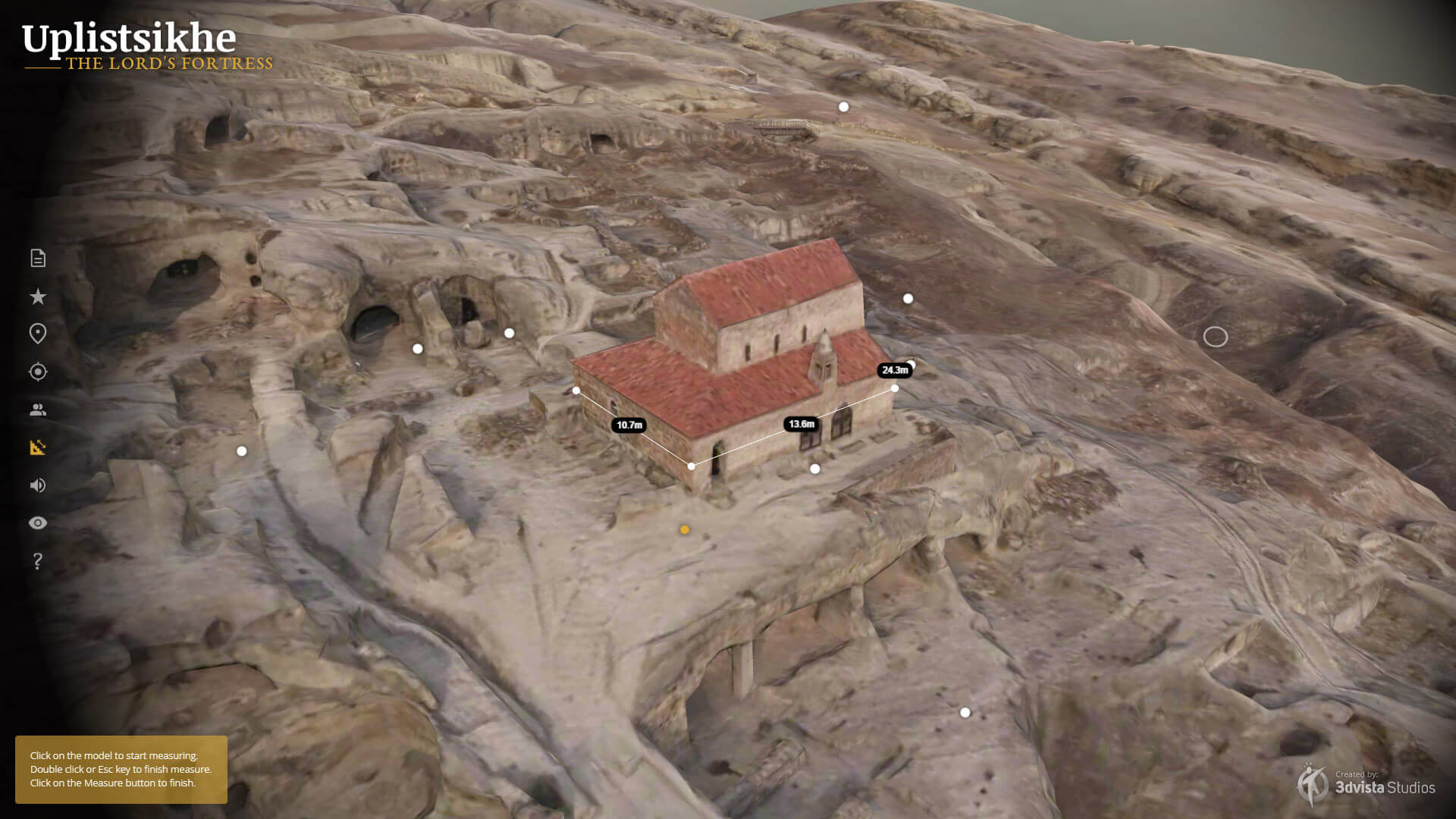
The main virtue of this demo is the ability to show a historical complex in a new way and allowing it to be examined entirely from any point of view, giving it a whole new dimension. That way, it can facilitate a better understanding of the layout, context, and measurements of a place, and gives it meaning by allowing us to delve into each area in detail. Indications in the form of text hotspots on the model make it easy to locate the various constructions and areas of interest. And the specific information windows allow us to expand the knowledge about each area in a useful and easy way. A new way of looking into and appreciating history.
Learn how to do it:
Includes:
- 3D Model (Fly-Over)
- 3D Hotspots
- 3D Sequences
- 3D Measurements
- Panoramas and 3D model connections
- Audios
- Dual Skins
- Complex Info Windows
Related Tutorial:
Tutorial 3D Orbital Mode